It doesn’t take long to get from the capital cities of Paris to Brussels, which are fairly close together. An hour and a half on a comfortable train will get you there.
This raises an intriguing question if you like that sort of thing: which capital cities of neighbouring countries are the closest together? And which are the furthest away?

There are some that one might think would be quite close, which are actually much further apart.
Buenos Aires, Argentina’s capital, sits on one side of the estuary of the Río de la Plata, while Montevideo, Uruguay’s capital lies on the other side.
But at 207km apart, they’re not really that close at all.
Similarly, Singapore always sticks in the mind as ‘that bit on the end of the Malaysian sticky-out bit’. But it’s actually pretty far away from Kuala Lumpur, Malaysia’s capital. A whole 319km away.
Thinking of ‘countries that cause problems by being close together’, you inevitably think of South Korea and North Korea.
And while Pyongyang in the North and Seoul in the South are pretty close together, 181km just isn’t going to cut it.
Close-together countries
Another place where countries being close together tends to cause problems is the Middle East. Damascus, the capital of Syria, really isn’t that far from Beirut, in Lebanon. Just 76km.
Most of the time, finding nearby capitals is a game of searching out which bits of the world have lots of small countries, and then rooting around. So, you’d think Central America would be ripe for close-together capital fun.
And yet the best option is Guatemala and El Salvador – where the imaginatively named Guatemala City is a whole 179km away from the also imaginatively named San Salvador.
Another obvious place with lots of small-ish countries is Europe – the site of the pair of capitals that drove me to write this in the first place.
And in fairness, Vienna and Bratislava do make a pretty good showing of it. Austria’s capital sits on the Danube; drift downstream, and you swiftly get to Slovakia’s capital. As the crow flies, it’s 56km – though as the human swims, it’s a little longer.
There are more surprising entries – particularly if you’re willing to bend the rules a little bit. Bahrain and Qatar aren’t really adjacent in the traditional sense, as they have no land border, but let’s just go with it.
Manama, Bahrain’s capital, is 140km away from Doha, the centre of the world’s thriving local connecting-flight-industry, which moonlights as Qatar’s capital.
Sticking with the maritime theme, Port of Spain in Trinidad and Tobago is 152km from St George’s, Grenada.
Castries, the capital of the Caribbean country of St Lucia, is 102km north of Kingstown, the capital of St Vincent and the Grenadines.
Better, but still not good enough.
Basseterre, the capital of St Kitts and Nevis, inches ahead at 100km away from St John’s, the capital of Antigua and Barbuda.
If you ask Google Maps to tell you the distance between the capital of Congo and the Democratic Republic of the Congo, it comes up with a rather suspect 20km.
A short distance, but considering the only thing separating the two is the River Congo, something’s up: Google places the centre of Brazzaville a little north of where it should be, and the centre of Kinshasa many miles south of where it should be, in some sort of suburb.
Turning to train stations
Though such transport hubs may not always perfectly mark the centre of a city – just ask London Oxford Airport or London Paddington – in this case, it seems about right.
Kinshasa’s main train station is helpfully called ‘Gare Centrale’, and is almost slap-bang in the middle of the area Google marks as ‘Centre Ville’. On the other side of the river, ‘Gare de Brazzaville’ is in the middle of lots of densely-packed buildings, and is right next to a Basilica, which is always a good sign.
And when marking that distance, you get a more realistic 4.8km. If you want to be really keen, the ferry between them travels 3.99km, and the closest point I could find between actual buildings was 1.74km, though admittedly that’s in a more suburban area.
Closest capital cities
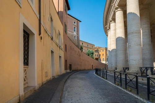
If you ask Google Maps to tell you how far away the Holy See, the capital of the Vatican, is from Rome, the capital of Italy, it says 3.5km.
If you set the centre of Rome to be the Palatine Hill, the ancient marking point for roads leading out of Rome, that narrows to 2.6km.
Fiddle a bit and put the centre of the Vatican as, well, the middle bit of the roughly-circular Vatican, which opens up a smidge to 2.75km.
Mark the centre point of the Vatican as the approximate location of St Peter’s Tomb within St Peter’s Basilica, which is after all the main reason the Vatican is a thing and not just a quirky suburb of Rome, and 2.67km is your answer.
Though obviously in practice Rome and the Vatican are as far away as one single step over the railings at the entrance of St Peter’s Square, which fairly blatantly makes them the closest capital cities in the world.
If you hadn’t worked it out already, the longest distance between a capital city and the capital of a country it shares a land border with is 6,395km, for Russia and North Korea.
[Read more: How Google Maps is ruining your neighbourhood]


