We’ve written before about the difference in scale between the official city limits of Paris and those of London, Several times; not to mention talking extensively about the metro and the Tube.
But something we didn’t discuss in those earlier articles is the knock-on effect this has on the two cities’ metro systems. People who care about such things often speak as if the two networks are equivalent: in some ways, however, the two perform entirely different functions.
Much of the London Underground was built in the great Metroland boom of the early 20th century, and was created to ferry people from the outer suburbs to the centre and back. As a result, although there are 270 Tube stations, these are spread over a vast area: one that’s 30km from east to west and 20km from north to south. The outermost station, Chesham, is nearly 40km from Trafalgar Square.
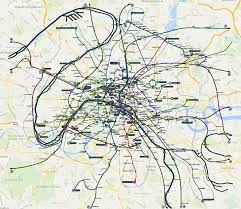
In Paris, by contrast, the metro was built primarily to get people around the city itself; and while some lines extend into the neighbouring communes, many don’t make it beyond the Périphérique. In all, there are 245 stations within the boundaries of the city itself – an area with a radius of just over 5km.
The Paris Metro, in other words, is much denser in its coverage. Both the lines, and stations on them, are spaced much more closely together.
It’s difficult to visualise what this would look like in another city – so, we’ve done it for you. We’ve used this geographically accurate map of the Paris Metro, and imposed it on a section of the London bit of Google Maps at the same scale.
What you get is, well, a bit of a mess.

(For what it’s worth, the dotted line is the city boundary, the dark blue lines with no stations on them are water – the Seine, obviously, and, to the north-east, the Canal Saint Martin.)
Paris Metro sits in central London
What you can see, though, is quite how closely spaced stations on the Paris metro actually are. Travelling on London’s Victoria line, it’s five stations from King’s Cross to Victoria. On this map, the mauve line 4 of the Paris metro tracks a similar route; that, though, makes 13 stops.
This is an extreme case – the Victoria line is the closest the Tube has to an express – but it’s replicated in smaller ways on other routes. On this map the blue line 2 runs just north of London’s circle line between King’s Cross and Paddington. That’s five stops in London; in Paris, it’s ten. Or consider the miniature 3bis line of the Paris Metro, which serves four stops on its 1.3km journey. London’s smallest line is the 2.37km Waterloo & City, which runs from Waterloo to Bank, and serves no other stations.
Possibly the record, though, is the 18 stops line 7 takes to wend its way in a roundabout fashion from Place D’Italie to Louis Blanc. The Bank branch of London’s northern line does a journey of the same length, from Oval to Angel, and that isn’t massively direct, either. Nonetheless, it does it in just eight stops.
Any Londoners looking at the tiny distances they’d have to their nearest metro station and salivating, though, should consider the flip side of this situation. In outer Paris, gaps between railway lines are often much larger than you’d expect in London.
This map isn’t comprehensive. Many lines continue beyond its edges; and while the map shows the express underground RER lines, it misses out the Transilien, the equivalent of national rail.
Even taking that into account, though, there are some very big holes in the network. Consider the vast gap to the east of the city, which on this map covers Tower Hamlets. No other trains serve that district.
Two thoughts stem from all this. One is the difference in functions performed by these different networks. In Paris, the Metro moves people around the city centre; the RER and Transilien ferry them in from the suburbs.
In London, though, there’s no such division: the Tube plays both roles. The Central line, say, acts like an RER route in the Essex suburbs, but a Metro route in Zone 1.
The other is that this might be one reason why so many Parisian banlieues are depressed: it’s much harder to generate a vibrant economy when there’s no way of getting to a job.
[Read more: Seven things you need to know about using the Paris Metro]


