“The Queen’s Gambit, except it’s me visualising the metro map on my ceiling when I can’t sleep.” That’s Samantha Berkhead of the Moscow Times’ review of what’s set to be the world’s most complex transport map. At first glance, proposals for the 2030 Moscow metro map are enough to keep anyone up at night, with its complex web of coloured lines, shapes and route transfers resembling the strategic imaginings of a grandmaster – memorising a single station would serve you well at a pub quiz.

Russia’s megacity needs a metro fit for purpose. (Photo courtesy of metro designers)
But like a brilliantly thought-out chess game, the logic of the map is best understood by its designers.
While Moscow is a formidable, even hostile, city by many estimations, it’s also one that has ongoing plans to become the most well-connected megacity in the world. The latest map for the expanding metro network, designed by Constantine Konovalov and produced by Natalia Moskaleva, does just that; it uses innovative and comprehensive design to map out a city that won’t stop expanding, in a way that continues to reflect these changes.
When the wider Moscow region (also, rather glamorously, known as ‘the Moscow megalopolis’) is included, the city’s population exceeds 20 million, making it the largest megacity in Europe and one of the biggest in the world. It is unsurprising, then, that connecting its citizens and visitors within the city itself is high on the agenda.
This might sound like a perplexing strategy during a time of social distancing, QR codes and remote working, especially as Russia faces a third renewed surge of Covid-19. But its capital city, and indeed the part of the country with over 1.5 million cases, is looking to the future.
Mapping out the future
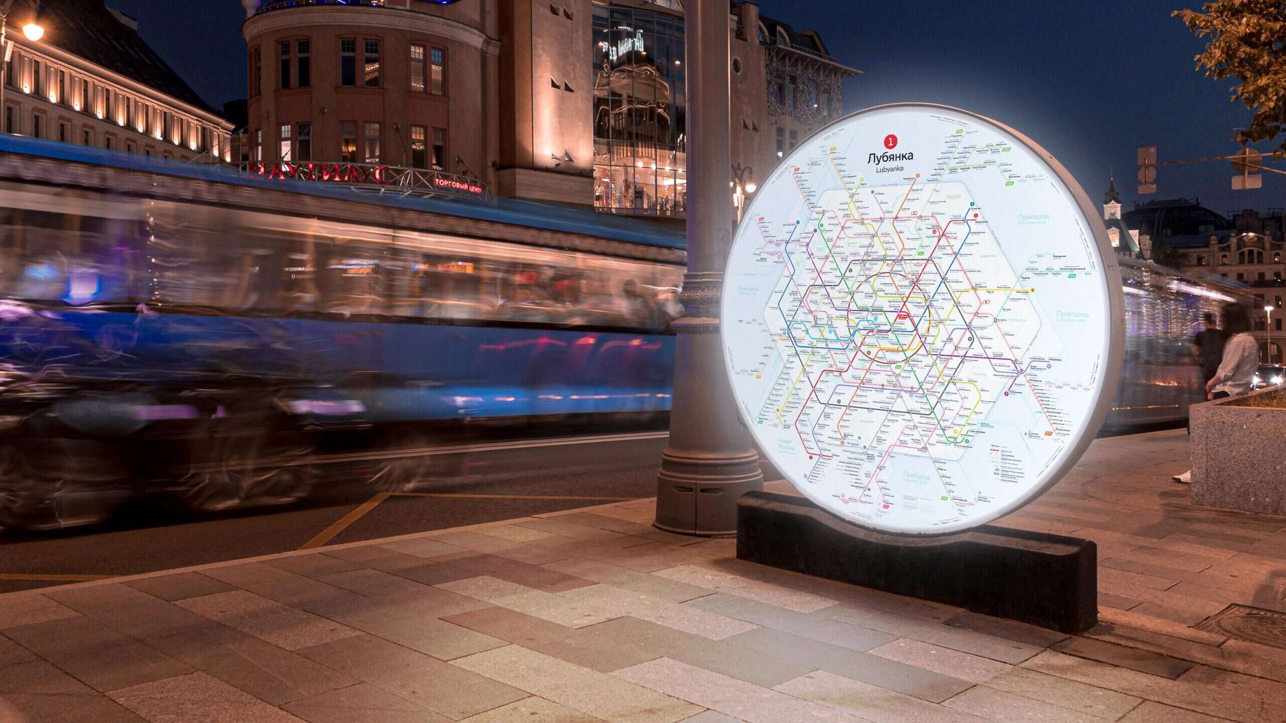
The Moscow metro first opened for passengers in May 1935, to a much smaller Soviet Moscow, and its image – and purpose – have remained malleable ever since. The current map is no longer fit for purpose as the city’s increasingly complex transit network needs one that reflects its geography. Not only that, but the metro network has become something of a tourist attraction itself, and it needs a comprehensive new system for citizens and tourists to enjoy – even at the risk of being overwhelmed.
Moscow’s metro has a long and rich history, so redesigning its entire appearance is no mean feat.

A city of rings: the new Moscow metro map proposal. (Photo courtesy of metro designers)
Often known as a city of rings, looping together roads, railways and Russians alike – as its population grew, so too did the cyclical infrastructure. Home to the Boulevard Ring, The Garden Ring – notorious for its lack of gardens – and the Moscow Automobile Ring Road, among others, the logic of loops, circles and rings maintaining a constant connection between people and place is central to Moscow life.
The first historical circular line appeared in the country’s metro scheme between 1950–1954. However, encircling the centre of the city and only 19.4km long, it left a lot to be desired as the city continued to mutate. While more circular lines appeared, slowly integrating railway lines along the way, the shape of the city – or rather its transport network – has had to unclench its fist to offer its citizens a more sensical and inclusive map that reflects where users physically are within the city.
Round in circles?
The original structure, some 70 years old, is something that designer Constantine Konovalov and producer Natalia Moskaleva are choosing to reform rather than regurgitate, as they present their vision for the map of 2030. Konovalov, who has worked with Moscow metro before, having previously designed the metro logo – another symbol of Muscovite transport that has seen its fair share of redesigns – which is characterised by a red letter M. It is unsurprising, then, that he and Moskaleva have been trusted with crafting the future metro map.
The designers have created a new approach to the graphic grid, one that currently looks like a sibling structure of the London underground network, shunning the classic scheme construction of a 45º angle grid, the post-popular schematic map design in the world and one that was, in fact, first introduced by Harry Beck for London tube lines.
What sounds like a minor change to someone more accustomed to using the subway than designing it, the new 60º axes will provide a more effective and balanced line network that diverges from the centre of the city, mirroring the real geography of the stations. The designers’ two new rings are not round, doing away with traditional Moscow logic, and all of the lines intersect with each other.
The science behind the new design is one of logic, practicality and style – taking into consideration geography, previous map lines, polygon angles and, of course, circles. The designers said: “When looking for a shape we wanted it to meet three requirements: visual equability (no empty or packed spaces), ease in finding your way and a recognisable shape of rings.”
They added, “we made the historical Circle line (5) round, but the new circular lines (11 and K) are hexagonal. This approach takes into account the further evolvement of the metro. Hexagons became the basis for a rare, yet geographically elegant grid with 60º angles.”
When looking for a shape we wanted it to meet three requirements: visual equability (no empty or packed spaces), ease in finding your way and a recognisable shape of rings.
By unravelling the complex intersections of the existing metro map, the designers exposed the bending lines outside of downtown Moscow. The result is, they hope, easier navigation and the juxtaposition of metro and city maps. The design does not just incorporate the routes themselves but has simplified transfers into “capsules” between stations, so users can easily understand when and how to move from hub to hub.
Mega Moscow
Moscow’s urban development is not only vast in scale but also fast in pace. Konovalov explains, “in recent years the pace of construction has increased so much that the number of stations on the scheme will double in the near future”. This is clear to see when the map of 2013, or even of today, is compared with the vision for 2030 – it looks like the network of two entirely different cities. And perhaps that’s the point, Moscow is a city that is only getting larger – in size and in scope.
While the complete vision of Konovalov and Moskaleva’s metro map is still a long way off, major developments to the network are due to be finished as soon as 2022. The underground Great Ring Line will be completed next year and is 70km long, with two new rings depicted by the designers as hexagons.
Russia’s status as an unmissable tourist destination is debatable, but it’s clear that a large ‘open’ sign hangs above the capital for its ever-growing population. There is no doubt that these changes are sure to attract tourists from elsewhere in Russia, as well as the rest of the world.
For Muscovites that manage to understand the map, they are set to have the world’s largest rail network on their doorstep, while Londoners still struggle to cross the Thames in under an hour.
In the contest to be crowned Europe’s greatest megacity, is this checkmate?


