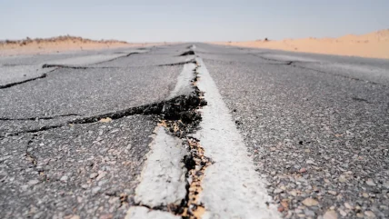
Most people in Seattle wear T-shirts and shorts most of the time. The skyline is shadowed by the friendly-looking Mount Constance. And, thanks to the city’s coffee-drinking tradition, everyone floats around in a happy, caffeine-fuelled haze. These may sound like glib generalisations, but I lived there for more than half a decade. They are, for the most part, accurate.
The city’s location on a tectonic plate boundary results in earthquakes every few years, but earthquake-proof construction techniques and regular school and office drills mean they leave the city, for the most part, untouched. The biggest earthquake during my time in the city hit in 2001; it knocked over a single pot of cocoa in our pantry with its vigour (a crime I’m pretty sure my mother still blames on me). One death was attributed to the quake. It was a heart attack.
But the city’s tranquillity has been given a sell-by date. FEMA, the Federal Emergency Management Agency, has predicted that a huge earthquake will ravage the entire northwestern United States at some point over the next 50 years. A long piece from Kathryn Schultz in the New Yorker lays out, in horrifying detail, the Emerald City’s shaky future. Take this section::
[The earthquake will] induce a process called liquefaction, whereby seemingly solid ground starts behaving like a liquid, to the detriment of anything on top of it. Fifteen per cent of Seattle is built on liquefiable land, including 17 day-care centres and the homes of some 34,500 people.
But I’m getting ahead of myself.
Why such a huge earthquake, and why now?
Seattle lies near to the boundary between the North American tectonic plate and Juan de Fuca, a large oceanic plate. The 700-mile plate boundary, known as the Cascadia Subduction zone, runs from northern California to Canada, and all along it, the Juan de Fuca plate is trying to force its way under North America. North America, in turn, is refusing to budge. This means pressure between the two is building, and building, and will eventually reach crisis point.
The crisis will, according to FEMA, play out in one of two ways. The first: only the southern section of the subduction zone gives way, which would give rise to an earthquake between 8.7 and 9.2 in magnitude. Schultz calls this “the big one”.
Then there’s the other option, the one FEMA is currently planning for. That’s the “very big one”:
When the next very big earthquake hits, the northwest edge of the continent, from California to Canada and the continental shelf to the Cascades, will drop by as much as six feet and rebound thirty to a hundred feet to the west—losing, within minutes, all the elevation and compression it has gained over centuries. Some of that shift will take place beneath the ocean, displacing a colossal quantity of seawater.
Sounds bad?
Well, it gets worse
The water will surge upward into a huge hill, then promptly collapse. One side will rush west, toward Japan. The other side will rush east, in a seven-hundred-mile liquid wall that will reach the Northwest coast, on average, fifteen minutes after the earthquake begins.
…Kenneth Murphy, who directs FEMA’s Region X, the division responsible for Oregon, Washington, Idaho, and Alaska, says, “Our operating assumption is that everything west of Interstate 5 will be toast.
Murphy goes on to tell Schultz that, although he is a scientist, he is desperately hoping FEMA’s science is wrong. Based on a test model of the quake, FEMA has predicted a death toll of around 13,000, with an additional 27,000 injured, and half a million displaced. A hot day could push the toll even higher.
FEMA predicts events like this so it can prepare for them; its predictions for the Seattle quake include the fact that it would need to provide food and water for around 2.5m people if and when the earthquake hits.
There’s not much anyone else can do, except hope the science is wrong, and maybe move a few of those daycare centres.


