Public open spaces in cities provide vast social, environmental and economic benefits, but for the community to enjoy them they must first be physically accessible, ideally walkable. With the important exceptions of people with motoric impairment, walking is the most common form of mobility and the most relevant for streetlife vitality, social equity and environmental sustainability. However, cities are hotspots of inequality and this can affect walkable access to public spaces. In a world with increasing inequalities, it is worth examining how access to public spaces varies according to economic differences.

What is spatial inequality?
Spatial inequality is understood as the manifestation in space of social disparities usually linked to people’s income, religion or race. This is a common problem in many cities. Stark socio-economic inequalities can be reflected in vastly different ease of access to urban infrastructure and services, including public open spaces. It is known that those with fewer economic resources tend to have less access to urban benefits, but it is important to analyse how walkable access varies in the city to diagnose and alleviate such social inequities.
As part of the Global Public Space Program, the UN seeks to promote connected, integrated and safe streets and public spaces in cities, especially for the most vulnerable. As part of this programme, the UN recommends a walkable radius of 400m as the maximum distance to access public open spaces in urban environments.
Why we shouldn’t disregard urban form
This ‘radius’ method of approximating walking distance commonly known as ‘crow-fly’ radius can differ vastly from the actual walkable access, constrained by the layout of urban blocks, as people must walk around buildings and fences. The total area reachable within a certain distance is known as a ‘pedestrian catchment’ or ‘pedshed’. The pedshed for a permeable street grid is just 64% of the area of the circle with a crow-fly radius, and can be much lower when dead-ends or large urban blocks are present. While the radius method was widespread in the past when calculating actual walkable access was prohibitively time-consuming, we now have many GIS-based tools that can produce precise and quick calculations.
The average size of urban blocks matters as well. While the pedshed may be the same for a grid of 70x70m blocks (as in Guadalajara) as is for a grid of 120x120m blocks (as in Lima), the former enables a larger number of routes between two distant points. This means a less repetitive daily walking routine, more surprise encounters with neighbours and strangers, and more public-private interfaces that can attract visitors. While this principle was eloquently explained in 1961, six decades later is still often ignored in urban planning practice.

Why topography matters
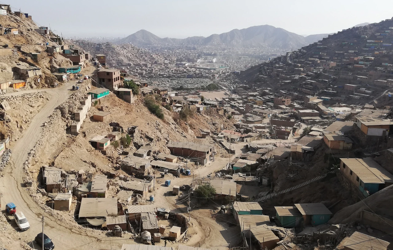
Topography also affects our ability to walk. In many Andean cities in Latin America, the settlement of hillsides or sloping land for habitation is common for low-income populations. They typically rely on walking and negotiating the slope is not a matter of choice but the only way to access affordable housing. These often informal settlements are self-produced, with street layouts and public spaces generated through self-organization. Such locations tend to be vulnerable to landslides and other natural disasters.
Walking on slopes involves a greater effort than walking on a flat terrain. The effort of walking uphill on slopes can be as much as 2.5 to 2.8 times that of walking on a flat area, so the maximum walkable radius should be recalculated for such conditions and is increasingly taken into account by GIS applications. Our research considers that, if the slope affects on average two of the four sides of an urban block, the walking effort would be about 1.75 times that of walking in a flat environment. The equivalent five-minute walkable distance on a steep slope has then been adjusted to 230m, as a simple approximation, but more differentiated modelling is also possible.

Improving urban spatial analytics
Testing a nuanced spatial analysis of walkable access to recreational open spaces for Lima reveals inequalities that wouldn’t be visible with a simplified crow-fly radius method that ignores urban form and topography. While even more nuanced analysis is possible by using multiple distance-time thresholds instead of just one, we argue that accounting for built form and topography should be the baseline approximation for future walkable access analysis. In our analysis, we used the open-source QGIS plugins AwaP and IC.

The inequalities of walkable access
Disregarding the effort of walking on a hilly topography can lead to overestimating walkable access in urban areas settled by the most vulnerable populations. This spatial pattern is particularly prevalent in Latin American cities.
Another important aspect to consider is the type and quality of public space to which one has access. For example, the same number or surface area of public open space, which can be a park or sports field, is well or poorly maintained. Areas where low-income groups predominate often have spaces of lower quality. This also represents spatial inequality that should be considered and mitigated. Capturing spatial inequalities accurately is a task that also requires engagement with the physical and cultural specificities. It is important to continue to develop tools that help us analyse and measure spatial inequalities to inform urban planning and design practice.
[Read more: The pandemic highlights the importance of walkable and wheelable neighbourhoods]
This article is published under copyright: CC-BY-ND.


